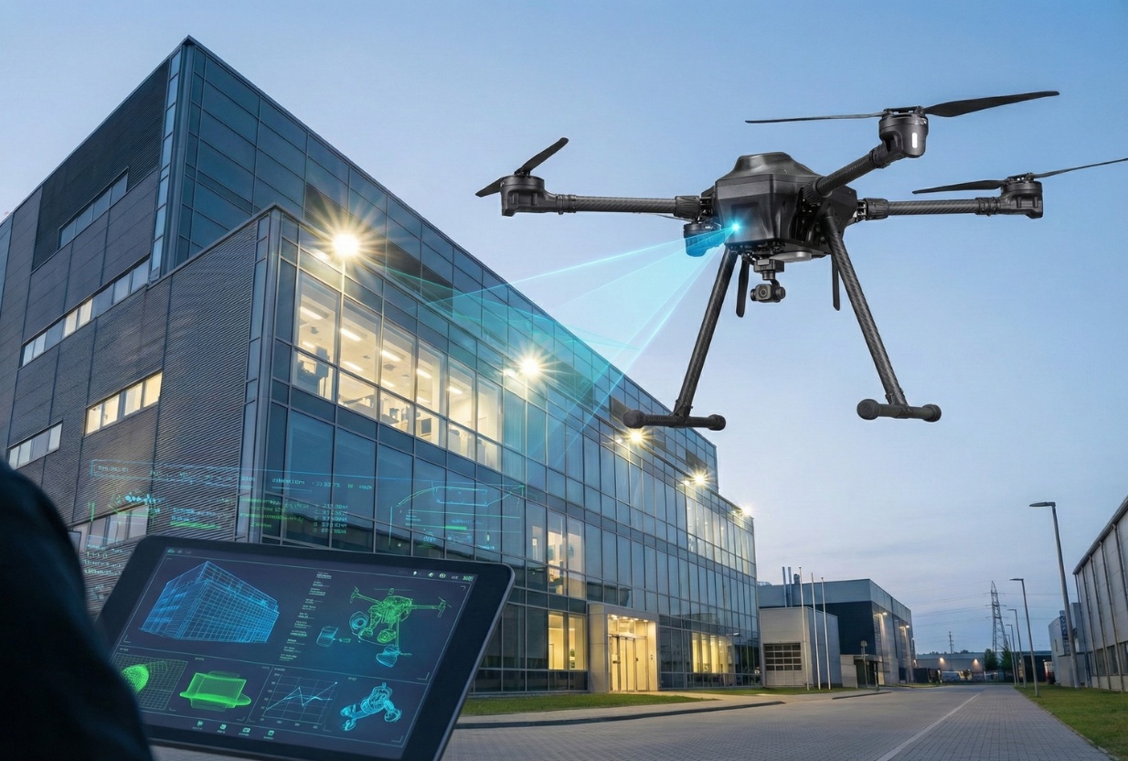
/Applications & Services
Construction & Infrastructure

1. Lifecycle Monitoring & Periodic Inspection
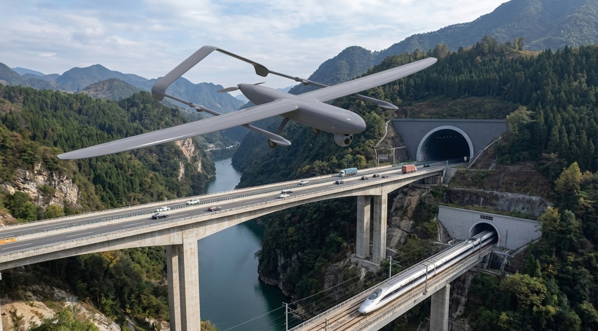
UAVs in bridge and road maintenance.
Road inspection and monitoring using UAVs.
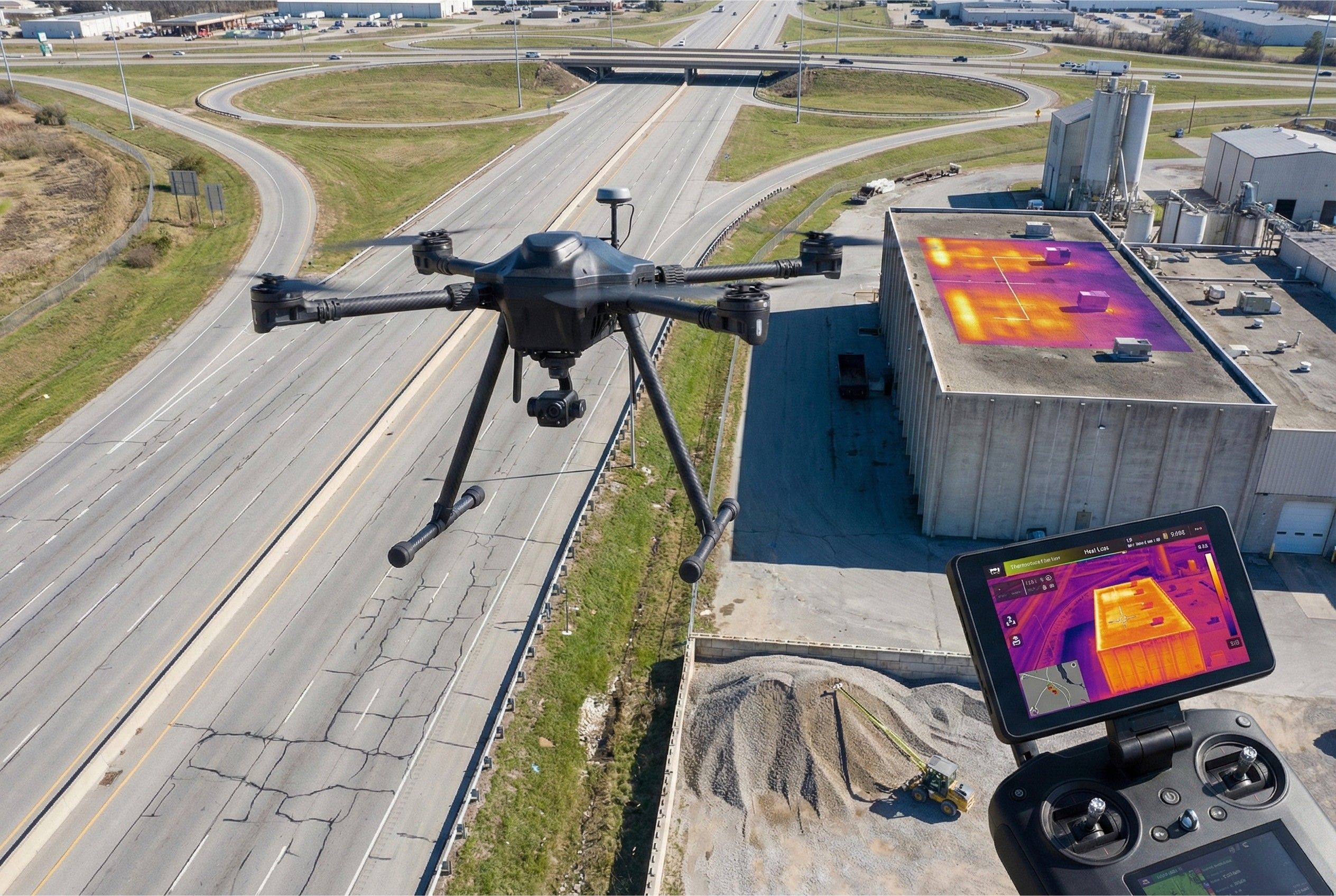
Industrial Management Platform - Gas System.
Highway monitoring.
Detect leaks and heat loss zones using thermal UAVs.
Monitor structural deformation and wear over time using RGB + AI Vision UAVs.
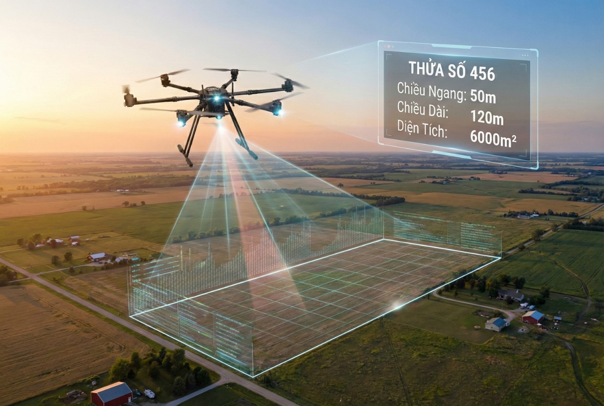
Measure material positions and volumes for BIM asset records using RTK UAVs.
Assess floor deflection and roof subsidence using LiDAR UAVs.
2. Construction Progress Monitoring
Illegal dumping detection (Construction waste).
Manage and track on-site materials and equipment. UAV with 30x optical zoom camera and AI object detection.
Supporting survey and comparison with original design.
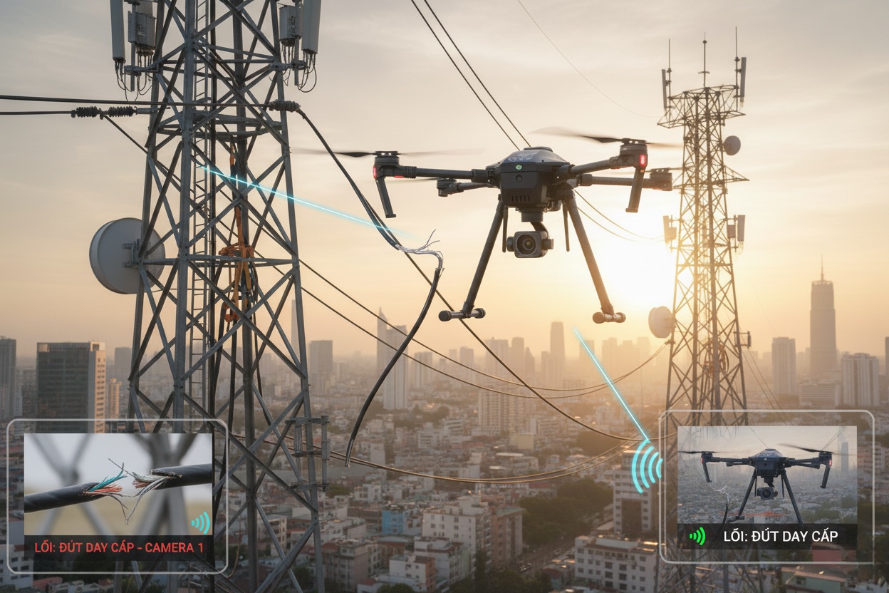
Detecting potential hazards in power lines and oil pipelines. UAV with thermal and infrared sensors.
Monitor real-time construction progress and detect deviations. Multi-rotor UAV with 4K RGB camera and RTK GPS positioning.
Capture construction progress imagery for BIM updates using RGB UAVs.
Construction progress.
Earthwork volume measurement using RTK/LiDAR/Earthwork volumetrics.
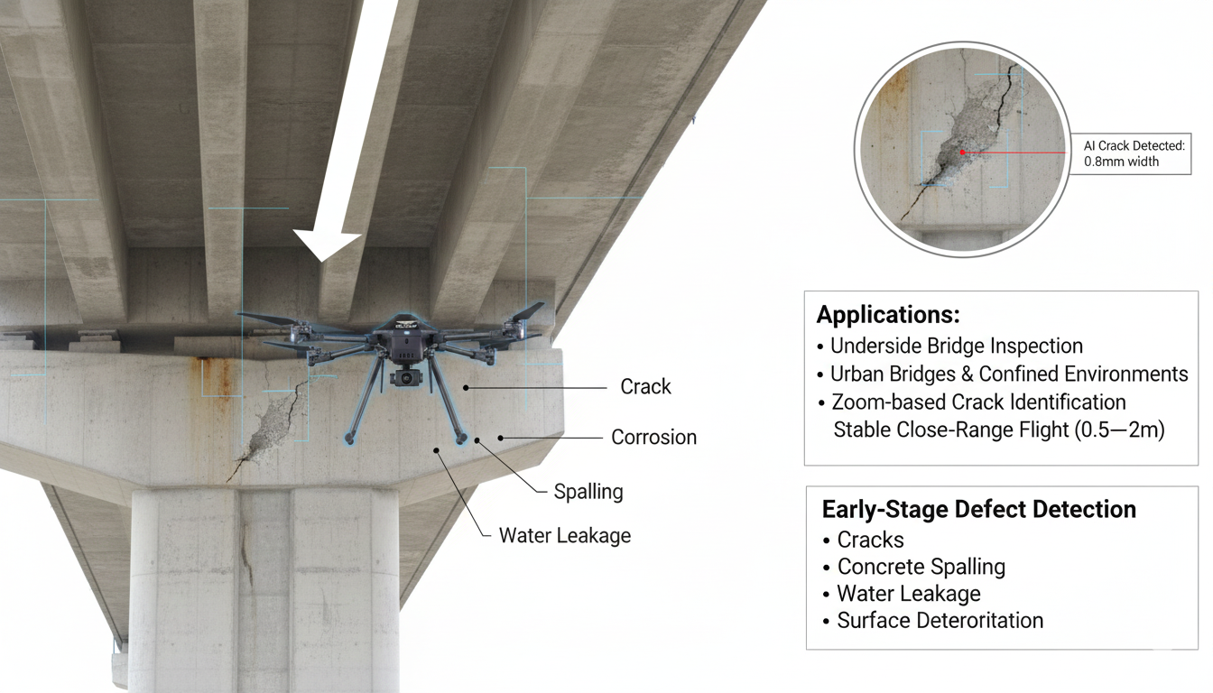
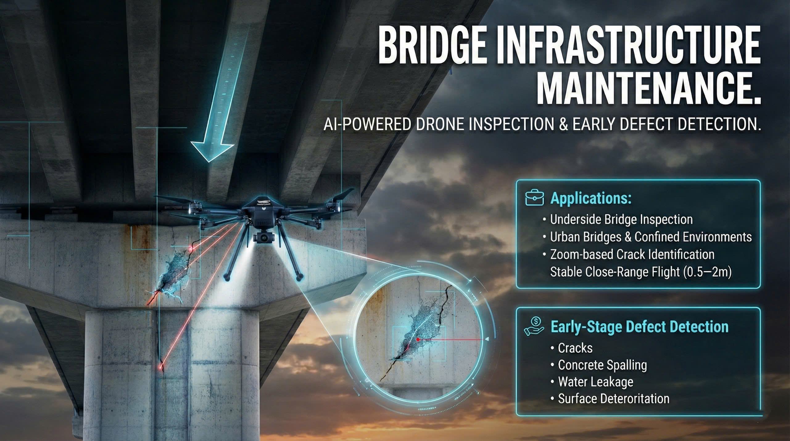
3. Structural Inspection & Safety
Weld & structure inspection – UAV with ultrasonic sensor & macro lens for detailed weld analysis.
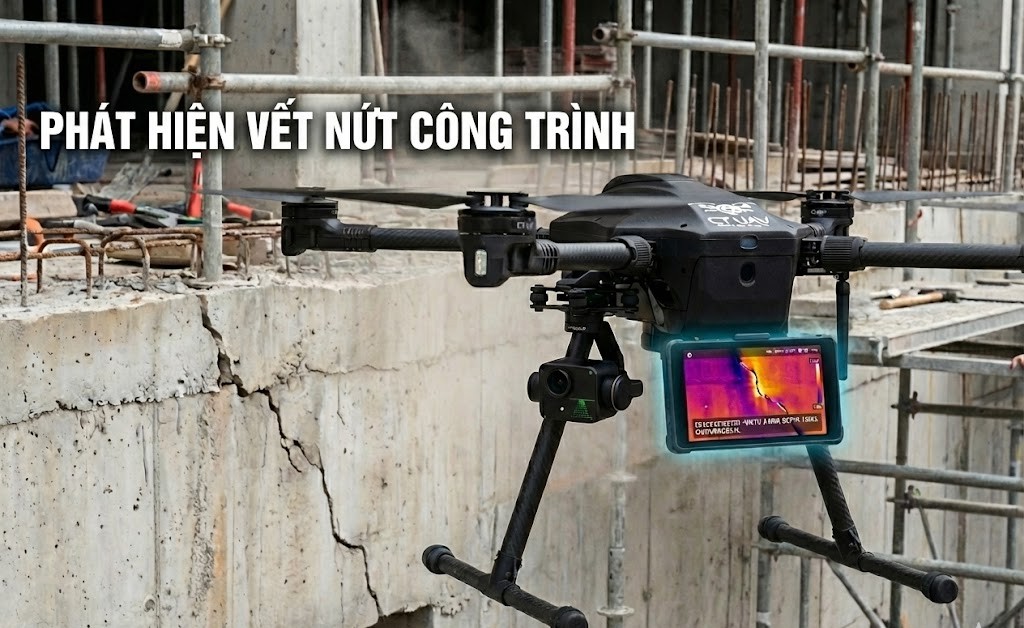
Concrete crack inspection – 8K AI or hyperspectral UAV for micro-crack detection.
Construction site thermal mapping – Dual-sensor UAV (thermal + RGB) for heat anomaly mapping.
Safety inspection at height – AI-vision UAV to detect missing PPE and unsafe work behavior.
Checking window and glass installation.
4. Infrastructure & Technical Facilities Management
High-rise building facade safety inspection.
Window cleaning drone service.
Analyze building energy and lighting performance using multisensor UAVs.
Verify MEP (electrical, water, HVAC) layout accuracy using RGB UAVs.
Map and synchronize outdoor–underground utilities into BIM using RTK UAVs.
Map underground utilities and technical infrastructure using LiDAR UAVs.
Integrated UAV robotic system for facade cleaning and inspection.
Mapping of underground power lines & sewers.
Monitoring bridges, tunnels, underground works.
PPE safety AI.
UAV-GPR utility routing pre-construction.
5. Urban Planning & Heritage Mapping
Virtual real estate tour – 360° UAV imagery for immersive property marketing.
Urban drainage & flow mapping – Multispectral UAV for hydrological analysis and flood mapping.
Urban drainage efficiency analysis – UAV GPR + multispectral sensors for subsurface water flow study.
Cleaning of skyscrapers (glass, facades).
Cultural heritage digitization – High-res RGB + LiDAR UAV for 3D documentation and preservation.
Coastal construction monitoring – Wind-resistant UAV with RGB + terrain sensors for erosion tracking.
6. Surveying & 3D Modeling
3D modeling of urban/industrial areas – UAV 4K imagery with 3D mapping software for visualization.
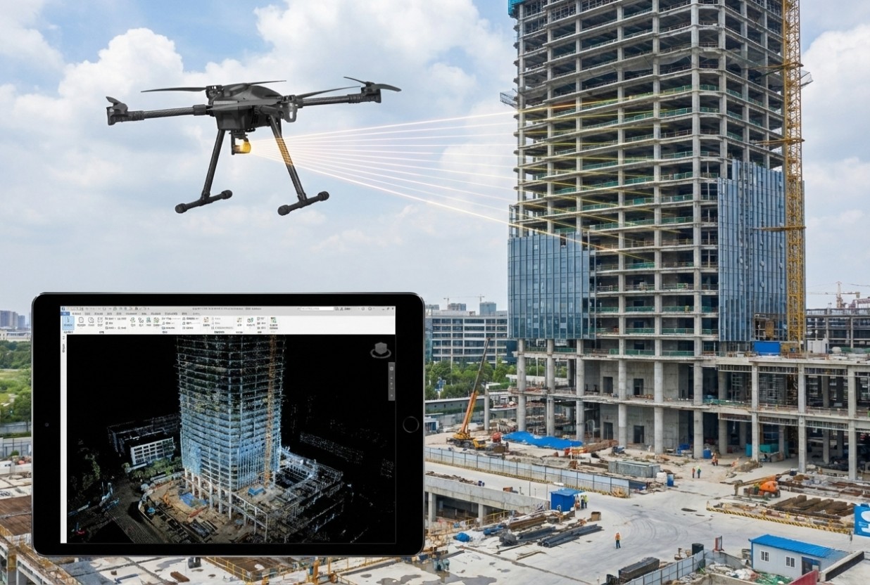
3D BIM mapping from UAV.
Landfill volume measurement – RTK UAV with RGB/LiDAR for accurate volumetric analysis.
Calculation of volume of soil, rock and materials.
Integrate 3D site data into Digital Twin platforms using RTK + RGB UAVs.
Generate and sync point clouds into BIM software using LiDAR UAV data.
Update BIM models with real-world changes captured by RGB UAVs.
Capture multi-temporal data to build 4D BIM models using LiDAR + RGB UAVs.
Conduct detailed topographic and foundation surveys using RTK UAVs with GNSS integration.
Collect surface and material data for design analysis using multispectral UAVs.
Generate 3D base maps for accurate BIM modeling using LiDAR + RGB UAVs.