/Applications & Services
Education, Training & Research

1. UAV training and skills development
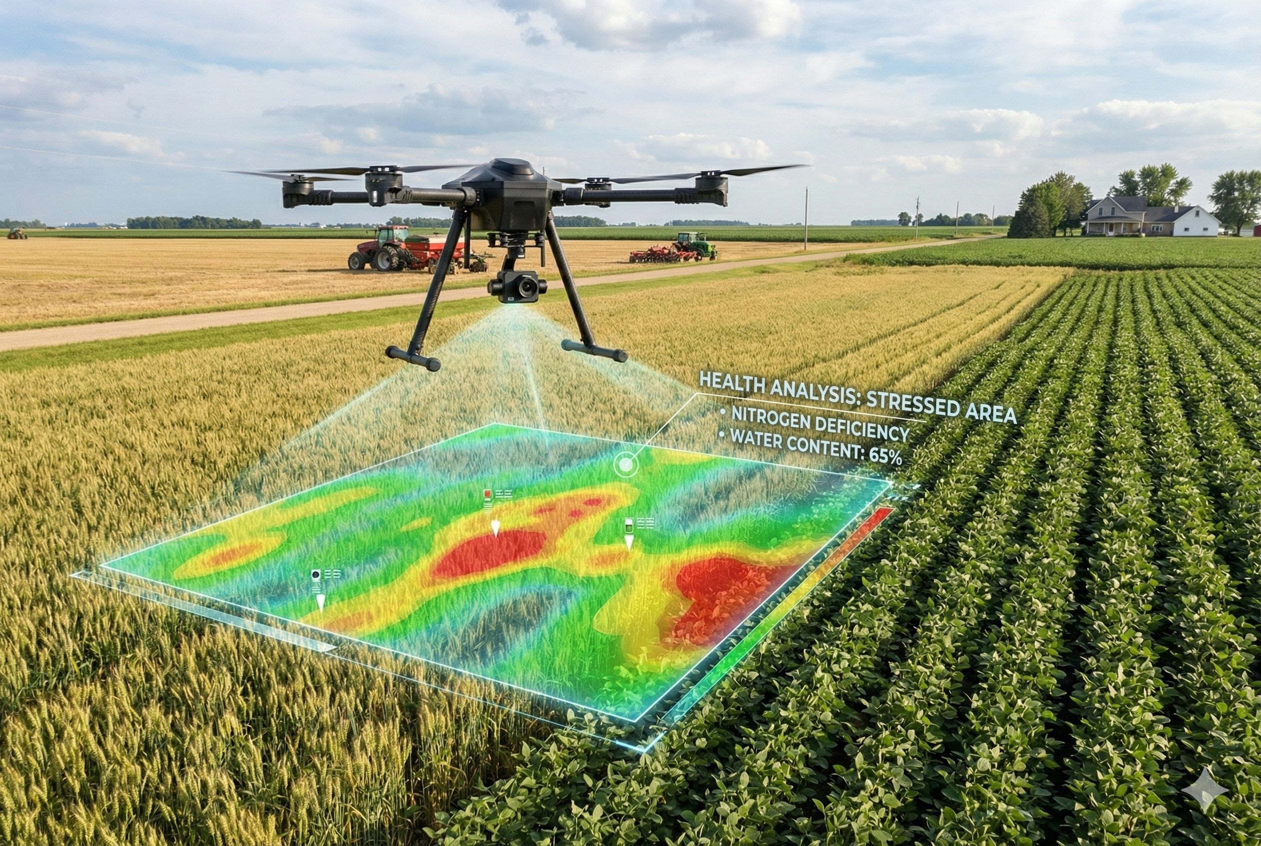
Training in Agricultural UAV Operations and NDVI Index Data Analysis.
Enable engineering students to design and test control algorithms and AI for UAVs in a virtual environment.
Conducting environmental science surveys.
Providing training in UAV and sensor operation for specific applications such as agriculture, infrastructure inspection, and search and rescue.
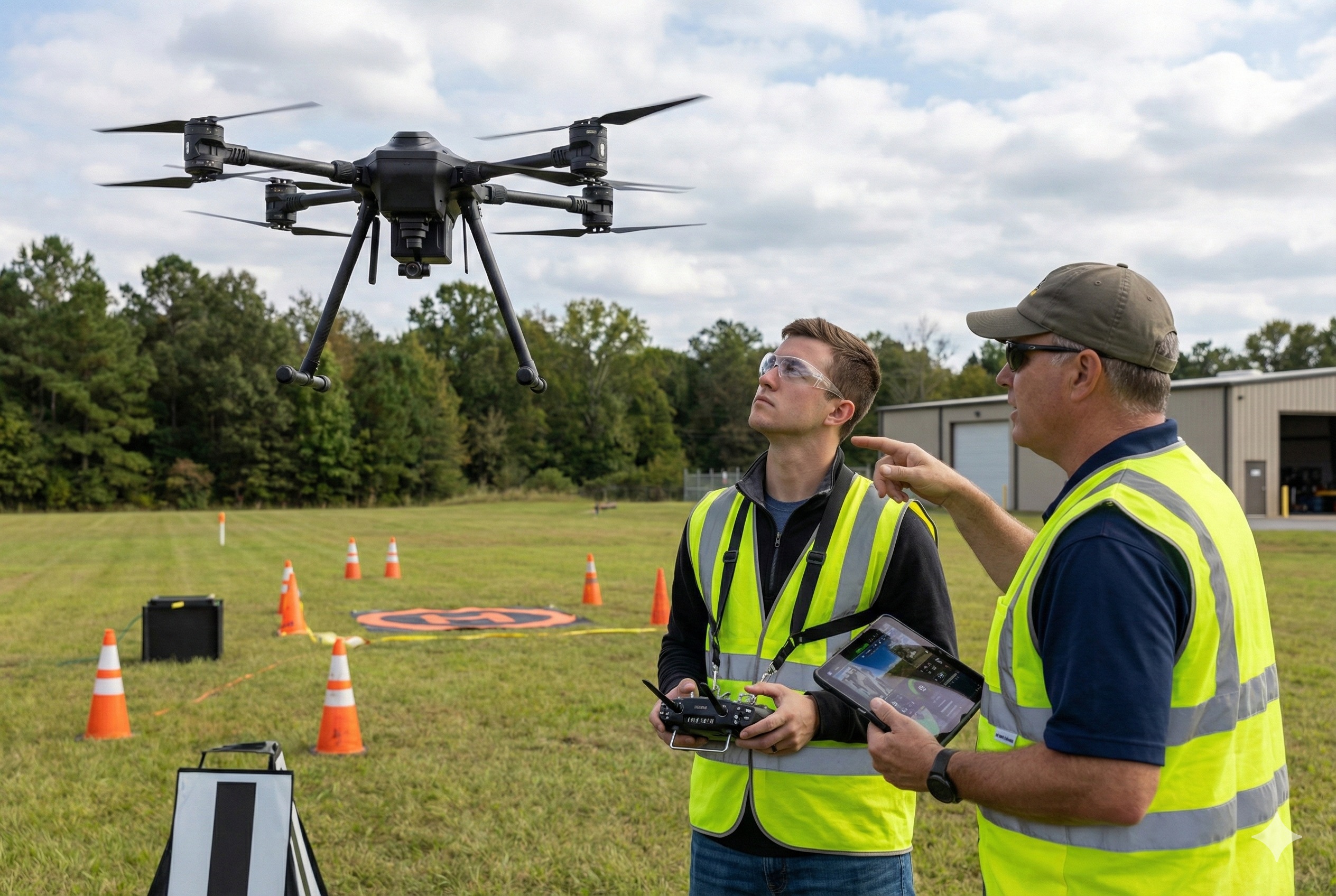
Provide flight training, route programming, and emergency response skills for both beginners and professional UAV pilots.
2. Ecosystem & Startup Support
Support faculty and students in accessing and utilizing modern UAVs for research and teaching purposes.
Establish infrastructure, training programs, and advanced UAV research that meet international standards.
Collect data on forests and crops to estimate carbon absorption and support carbon credit projects.
Provide space, resources, and mentorship for startups developing UAV-related products and services.
Multispectral/thermal data processing toolkit.
Pilot & mission training.
3. Research collaboration on new technologies

Develop tools for 2D/3D mapping, multispectral/thermal data analysis, and UAV-based information visualization.
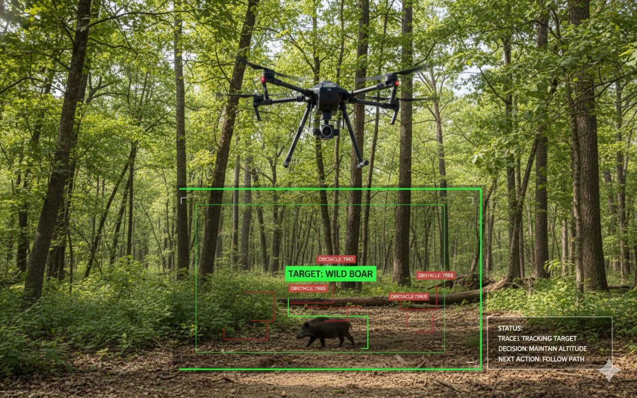
Develop UAVs capable of autonomous object recognition, tracking, and real-time decision-making during flight.
Develop UAV systems that collect data from distributed IoT sensors or deploy new IoT sensors.
Research algorithms that enable UAVs to fly autonomously without human control, or operate simultaneously as a coordinated fleet.
Performing aerial surveys for oceanographic research.
4. Scientific Research & Field Survey
UAV Research and Education for Wildlife Conservation.
Conduct topographic surveys and generate 3D models to support geological and hydrological studies (flood forecasting, erosion analysis), coastal surveys.
Monitor air and water quality, detect gas leaks, and inspect landfills or industrial pollution sites.
Assess plant health, detect crop diseases, monitor animal populations, and oversee habitat conditions.
Monitor algal blooms, measure seawater parameters (temperature, salinity), and support shallow seabed surveys.
5. UAV applications in education – Learning modeling
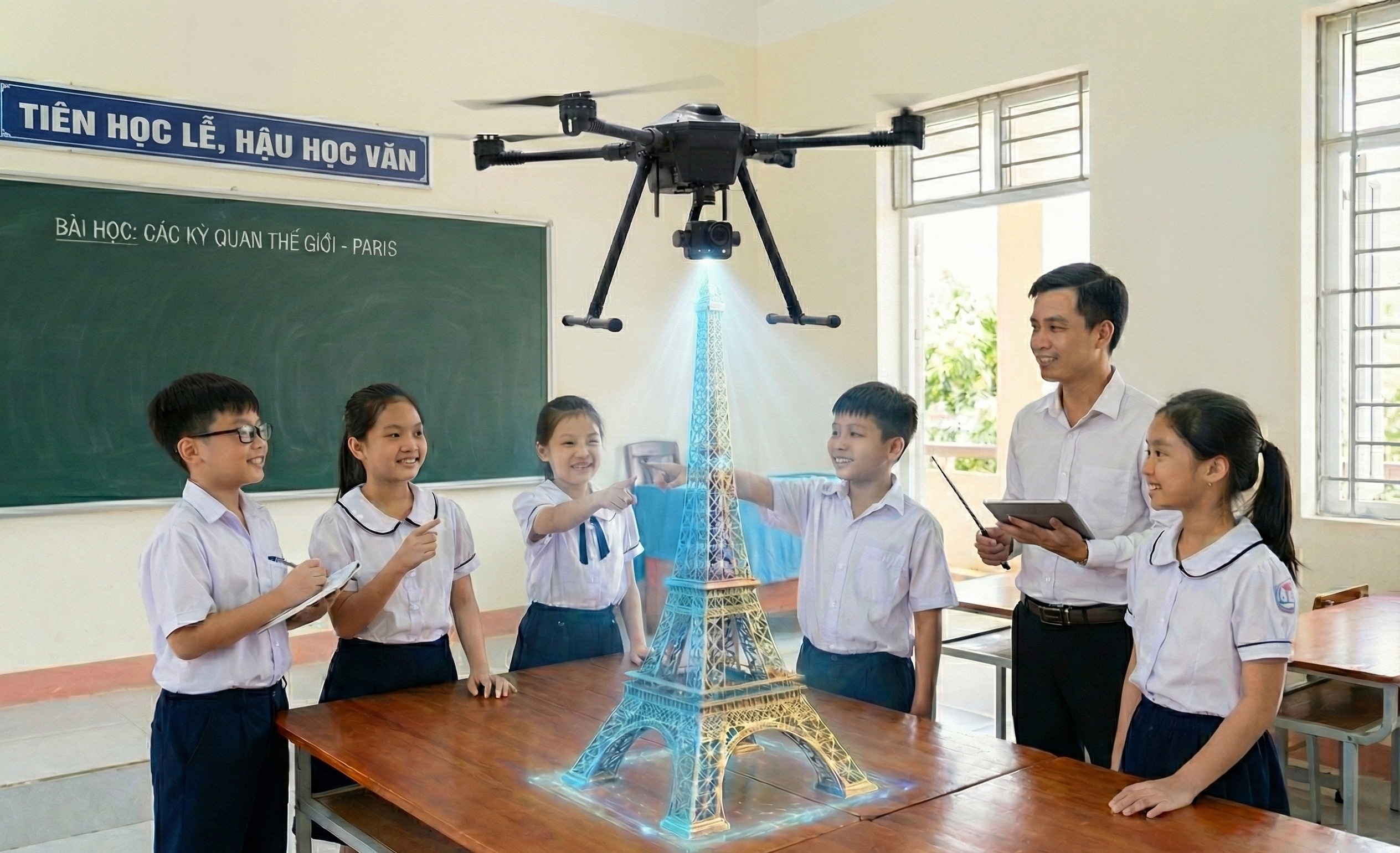
Capture images and create 3D models of monuments, structures, and terrains to support the teaching of history, geography, and architecture.
Teach students about electronics, programming, and flight principles through assembling and operating UAVs.
Students practice flight planning, collect orthophotos, and process data using GIS software.
Create a platform for students to develop UAV piloting, programming, and design skills through competitions.
Student practicals on thermal/multispectral processing.