/Applications & Services
Public Safety, Security & Firefighting

1. Protection Of Critical Persons, Events, And Infrastructure
City event crowd monitoring (safety-first).
AI-powered aerial security network using autonomous drones to protect tourists.
UAV-based autonomous no-fly zone management and rogue drone detection.
UAV security monitoring for VIP events with AI detection + camera zoom 30×.
Monitoring and escorting government/diplomatic motorcades through autonomous UAV coordination.
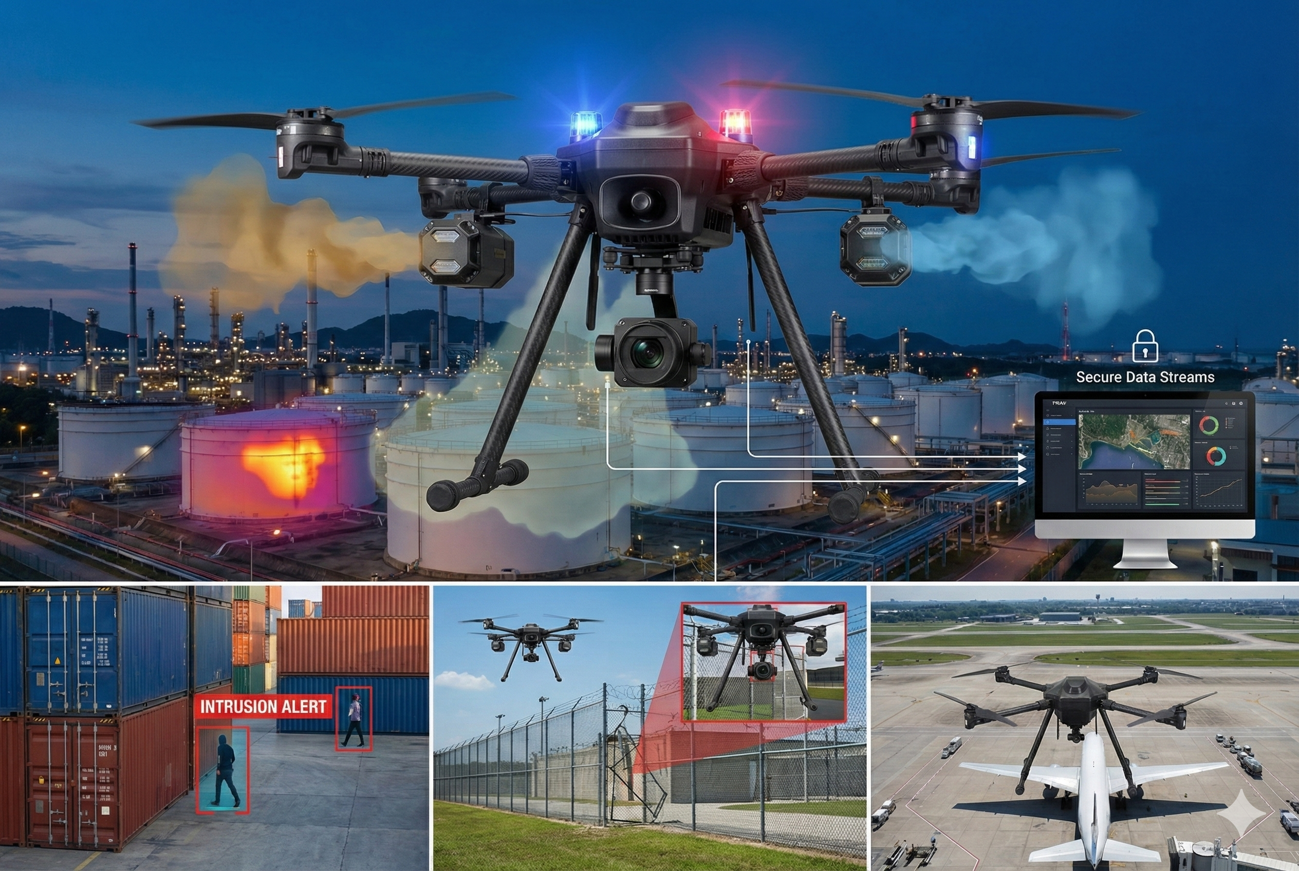
Night shift surveillance in industrial zones using UAVs equipped with thermal sensors + low-light cameras.
Perimeter UAV surveillance for open-air venues around grandstands, stages, and festivals.
2. Urban & Public Safety Monitoring
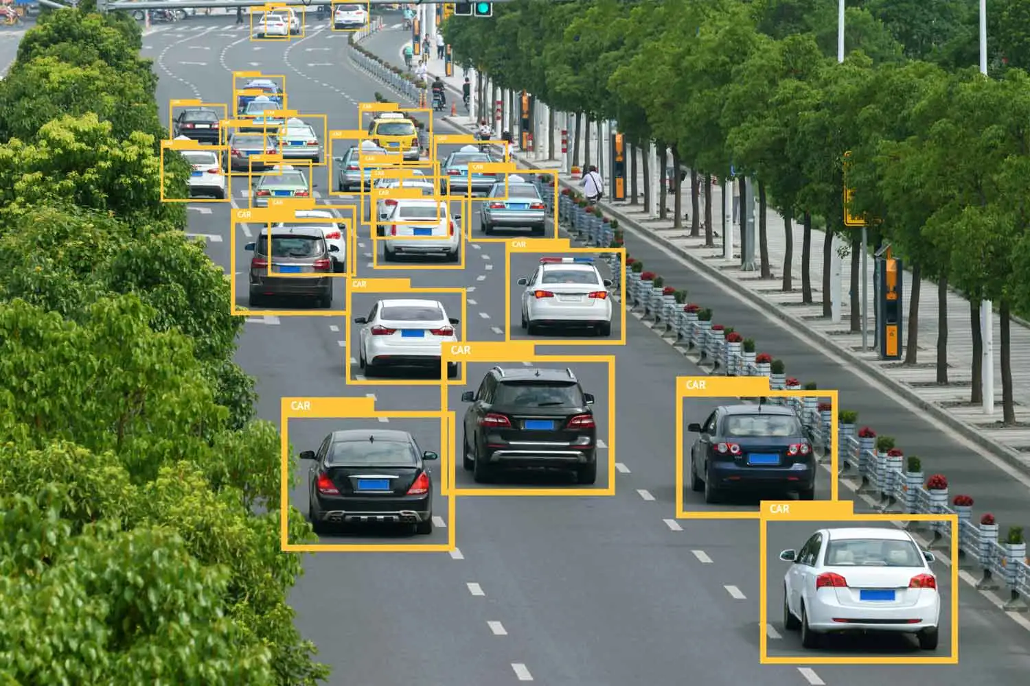
Intelligent Road Traffic Monitoring and Management - Automating Collection, Inspection and Decision Making with UAV.
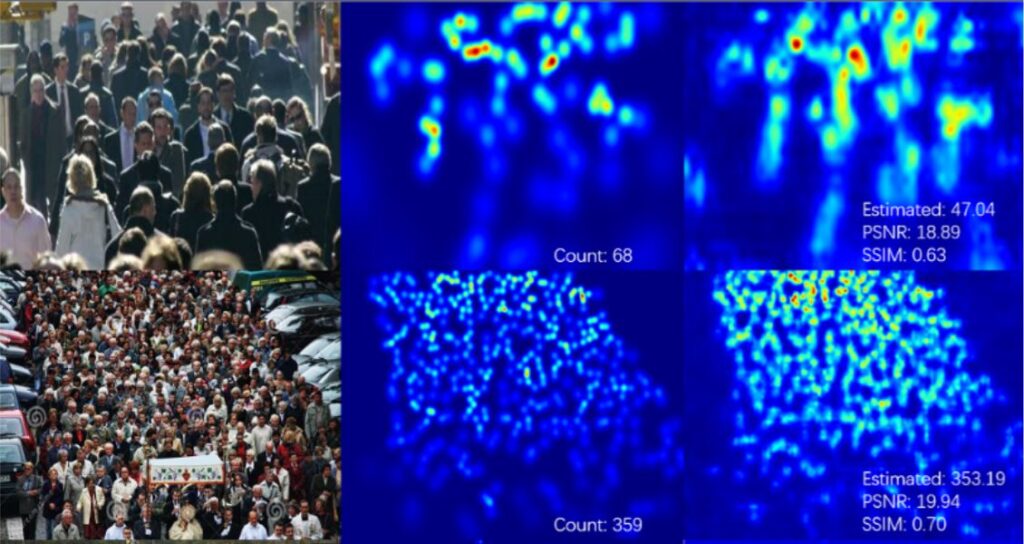
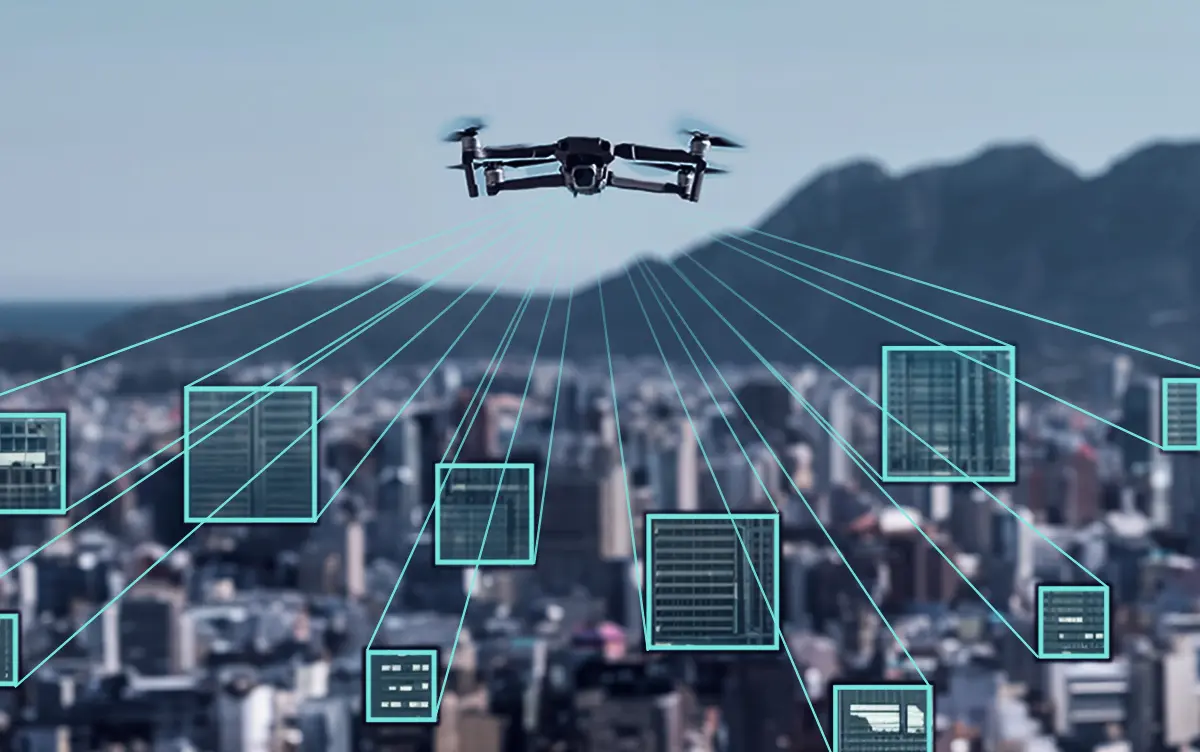
Crowd monitoring UAV with AI-based density and anomaly detection.
On-device crowd density heatmap with "privacy-preserving" processing.
Riot and vandalism behavior detection UAV using AI video analytics.
Real-time urban traffic monitoring UAV with vehicle recognition AI.
Supporting police forces in facial recognition, tracking, and suspect pursuit operations.
UAV automated illegal parking detection and license plate capture.
Detecting traffic collisions and automatically transmitting image data to police headquarters.
UAV event surveillance and violation recording for large-scale gatherings.
Aerial crime scene investigation UAV with 8K RGB + multispectral imaging.
UAV with object recognition AI for detecting weapons or dangerous objects.
Public asset vandalism detection (AI).
LPG rooftop tank surveillance (thermal + gas).
Crowd density & anomaly.
3. Monitoring Of Critical Facilities & Industrial Zones
Visual vibration monitoring of stacks/towers.
UAV in monitoring wildlife reserves.
Toxic gas or localized fire detection using UAVs equipped with thermal and gas sensors.
UAV audio-light alert system for deterrence and emergency broadcast.
UAV surveillance for logistics, yards and civilian ports.
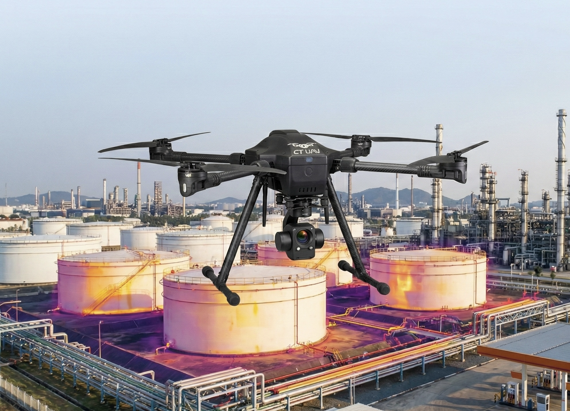
Fuel and chemical depot monitoring UAV with thermal and gas sensors.
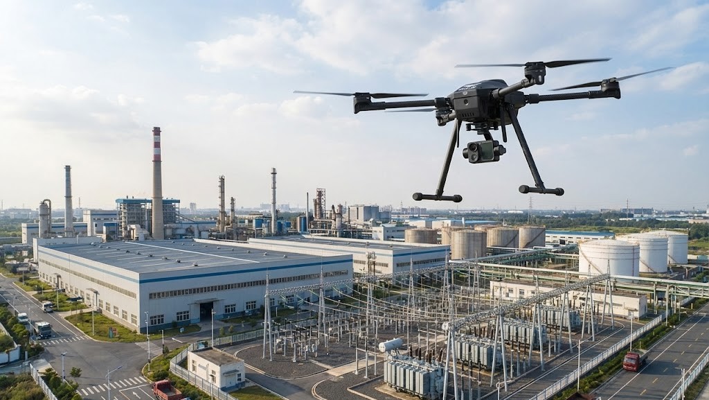
Industrial perimeter UAV patrol with intrusion alerts.
Plant, industrial zone 24/7 UAV patrol with automated flight paths.
Automated UAV surveillance for prisons, detention centre and high-security zones.
Airport apron security inspection UAV with optical zoom.
Intrusion and fence-breach detection UAV with motion AI.
4. Urban & Industrial Fire Safety Supervision
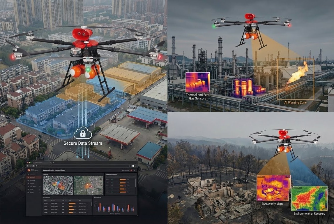

Fire risk AI data collection using UAVs captures visual and environmental data to train predictive AI models.
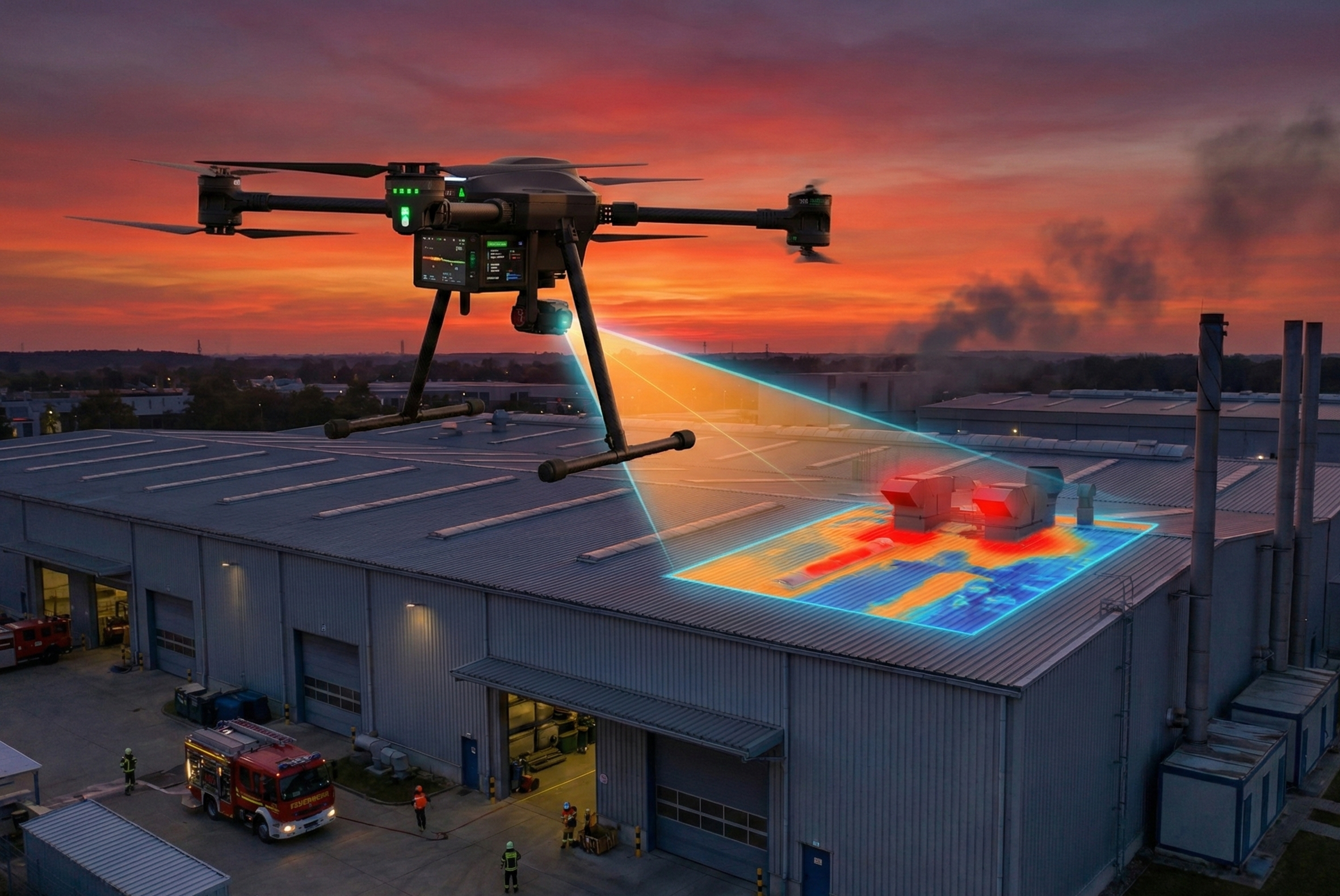
Pre- and post-fire thermal mapping using UAVs generates comparative heat maps for damage and insurance assessment.
Industrial heat and gas leak monitoring using UAVs with thermal and gas sensors detects early fire and explosion risks in factories and fuel depots.
Burn area analysis using multispectral UAVs measures burned zones to support environmental restoration.
5. Firefighting Assistance & Rescue Support
Firefighter hotspot & plume mapping.
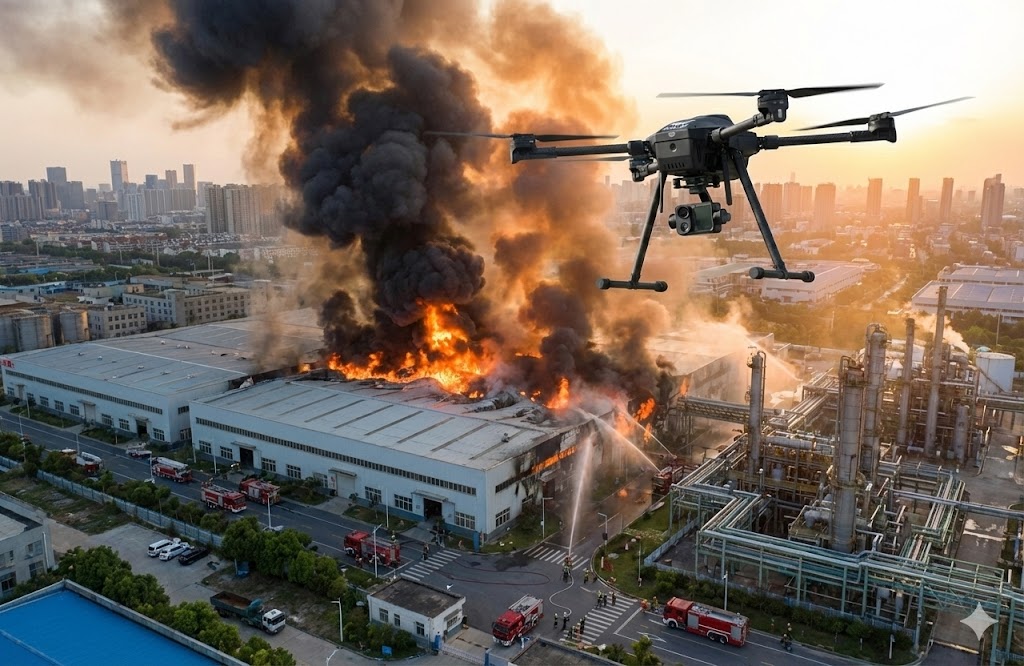
UAV in firefighting in residential areas and high-rise urban buildings.
Rescue Drone: An Integrated AI Firefighting UAV for Fire Disaster Mitigation in Large Urban Areas.
Integrated AI Firefighting UAV for Peatland Disaster Mitigation.
High-pressure direct-spray UAV precisely targeting localized fires involving machinery, electrical poles, or industrial equipment.
Combined spraying and bombing UAVs forming a firebreak by dispersing fire-retardant along wildfire perimeters.
Hose-laying UAV capable of lifting and routing hoses from fire trucks or hydrants up to 100m for high-rise or large-warehouse firefighting.
Provides detailed 3D maps of fire-affected sites to assess damage extent and support post-incident recovery.
UAV thermal mapping to identify potential wildfire or spread-prone areas for early warning and fire-prevention planning.
Dual-sensor (RGB + Thermal) UAV for tracking fire spread direction and perimeter analysis using AI.
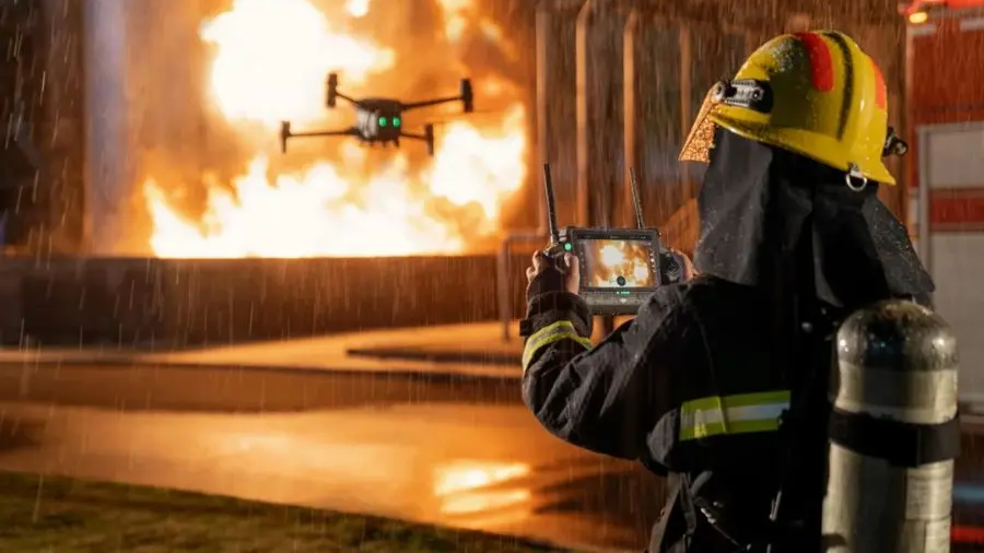
Zoom UAVs with 4G/5G live-streaming for real-time situational awareness during firefighting operations.
High-rise fire thermal mapping for incident command.
UAV-mounted low-pressure water or foam sprayers for localized firefighting in hard-to-reach areas.
Mini UAVs extinguish small fires in confined or electrically hazardous areas.
Equipped with precision-release system (4 fire-suppression balls/sortie), targeting wildfires and rugged terrain fires.
Autonomous loudspeaker UAV broadcasting evacuation instructions along pre-programmed safe routes, operable under wind level 5–6.
Precision fire-retardant drops.
6. Geological hazard monitoring
Post-eruption lahar path modeling.
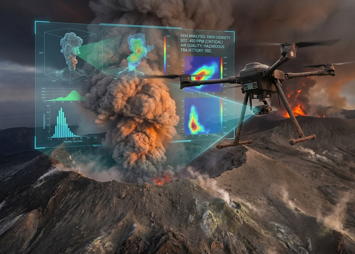
Volcanic gas & ash plume monitoring.
Volcano mapping using LiDAR.
The application of UAVs in detecting signs of volcanic activity.
Volcano monitoring using uav intergrated with sensor.