/Applications & Services
Telecommunication & Digital Infrastructure
1. Coverage & Performance Analysis

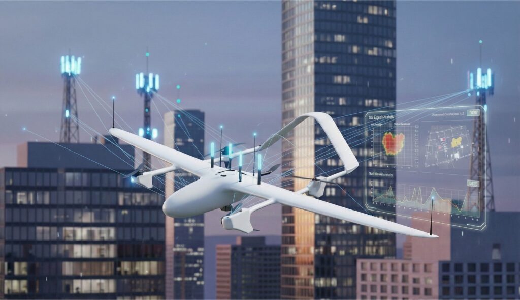
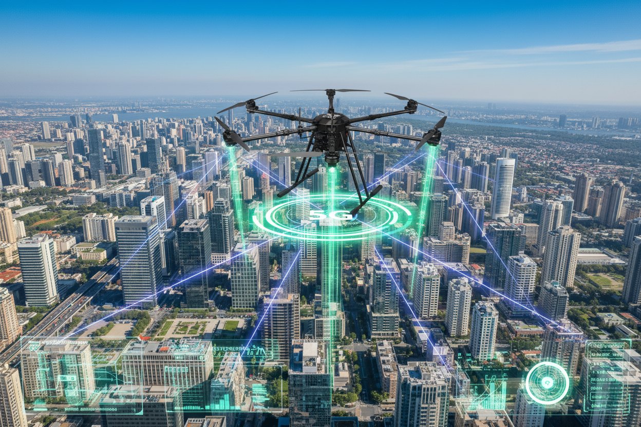
UAV in Supporting 5G/6G Telecommunication Coverage.
Mapping underground cable networks with UAVs by capturing spatial data and processing it with GIS technology to identify cable routes, support planning, infrastructure management, and reduce construction risks.
Inspecting virtual coverage areas with UAVs by collecting spatial signal data and generating coverage simulations, supporting service quality assessment and network design optimization.
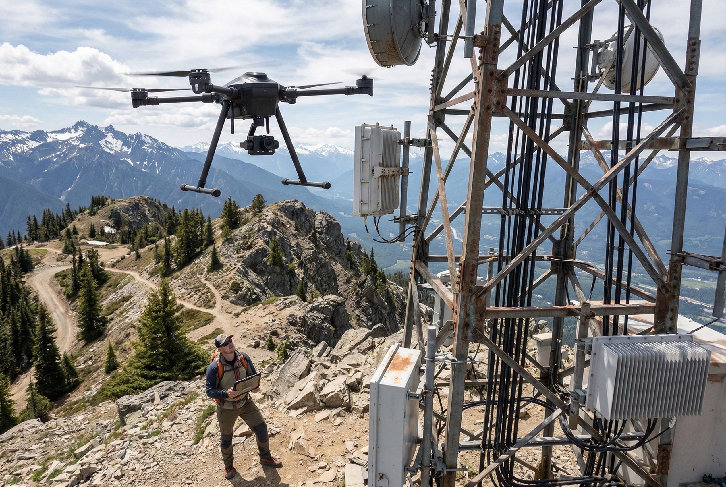
Measuring 5G signal strength in remote areas with UAVs by collecting spatial and altitude-based signal data, supporting coverage assessment, telecom infrastructure optimization, and connectivity expansion.
Integrating UAV data with SCADA to collect and transmit imagery and technical parameters into centralized monitoring systems, enabling automated analysis, fault detection, and optimized operations.
Assessing new coverage areas with UAVs by collecting and analyzing signal data to determine connectivity quality, support base station deployment, and optimize telecom infrastructure.
Measuring BTS tower tilt with UAVs using sensors and image analysis to detect structural deviations, identify safety risks, and support timely maintenance.
2. Transmission & Fiber Network Monitoring
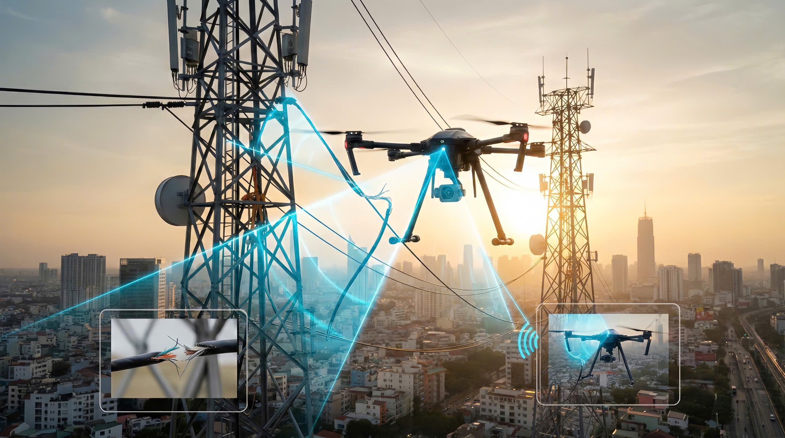
Monitoring fiber optic lines with UAVs to inspect cable conditions, detect issues early, support efficient maintenance, and minimize service downtime.
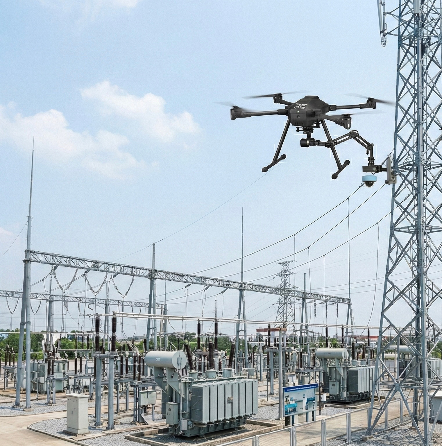
Supporting regular maintenance using UAVs to capture aerial imagery and data of structures or equipment, enabling early fault detection, reducing worker risks, and optimizing maintenance costs.
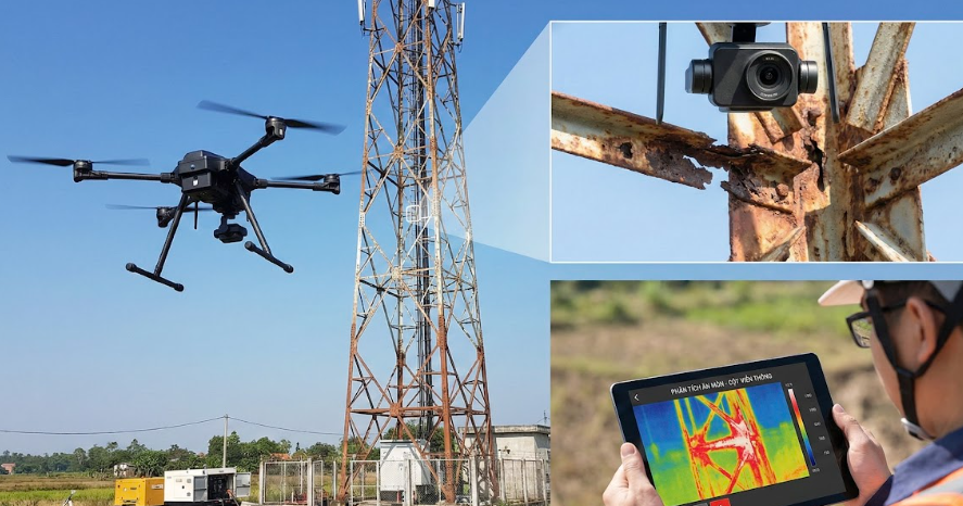
Inspecting corrosion on telecom iron towers with UAVs using high-resolution cameras and image analysis to detect rust and structural damage, enabling timely maintenance and extending infrastructure lifespan.
UAV mapping of telecom transmission lines.
3. Network Planning & Deployment
mergency cellular relay & connectivity (Tethered drone).
Inspecting 5G signal interference using UAVs equipped with specialized measuring devices to collect and analyze spatial interference data, identify causes, optimize network infrastructure, and improve service quality.
Surveying locations for building 5G stations with UAVs by capturing terrain and signal data, supporting optimal site selection, reducing manual survey costs, and accelerating deployment.
Assessing wireless transmission quality in new residential areas.
Supporting wireless transmission network design with UAVs by collecting spatial and signal data to analyze connection routes, optimize network configurations, and improve deployment efficiency.
4. Tower Inspection & Maintenance
Providing UAV marketing filming services to deliver aerial footage for brand promotion, events, and products, producing professional media content that engages customers.
Inspecting BTS towers using UAVs equipped with high-resolution cameras to examine structures, cables, and telecom equipment, enabling damage detection, reducing worker risks, and optimizing maintenance costs.
Filming real estate projects with UAVs to capture aerial views of sites, infrastructure, and buildings, producing compelling visuals for marketing, sales, and investor attraction.
Inspecting TV antennas with UAVs using aerial cameras to monitor structural and equipment conditions, enabling early damage detection, reducing technician risks, and lowering maintenance costs.
5. Station Energy Management And Monitoring
Installing small devices on tall poles using UAVs to mount sensors, cameras, or transmitters without manual climbing, minimizing safety risks and reducing maintenance costs.
Assessing the environmental impact of transmission stations using UAVs by collecting spatial and visual data to analyze effects on landscapes, ecosystems, and local communities.
Monitoring remote telecom site operations with UAVs by capturing real-time imagery and data to track equipment status, detect anomalies early, and support remote management.
Monitoring telecom stations in mountainous areas with UAVs to inspect equipment and surrounding environments in hard-to-access terrains, enabling early fault detection and improving maintenance efficiency.
BTS tower inspection using UAVs.
Fiber optic line inspection using UAVs.
5G signal strength measurement in remote areas.
UAV-based 5G RSRP/RSRQ measurement for new urban developments.
5G mmWave beam mapping in high-rise buildings.
Line-of-Sight (LOS) survey for 5G site planning in hilly terrain.